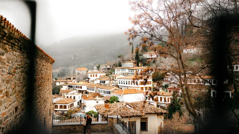
Pelion map: the villages by area and how to plan your route
Pelion is a mountain that runs down to two seas, with dozens of villages along the way. Here are its areas, the standout villages in each and how to turn the map into a route.
- Pelion splits into three areas: the centre above Volos, the east facing the Aegean and the quiet south.
- The most visited villages are Portaria and Makrinitsa, about 11 km from Volos.
- In the east are Tsagarada and Zagora with beaches such as Mylopotamos; in the south, Vyzitsa, Milies and Milina.
With 3–4 days, sleep in two areas: the first nights in the centre or east and the last nights in the south by the gulf. The roads are mountainous and slow, so don't overplan each day.
What does the Pelion map look like?
Pelion is a mountainous peninsula east of Volos, between the Pagasetic Gulf to the west and the Aegean to the east. The mountain is covered in chestnut and beech forests, with villages scattered across its slopes. Discover Greece groups the villages into three areas, which is also the simplest way to read the map:
| Area | Where | Standout villages |
|---|---|---|
| Central Pelion | above Volos, towards the summit | Portaria, Makrinitsa, Chania, Drakia |
| Eastern Pelion | facing the Aegean | Tsagarada, Zagora |
| Southern Pelion | the southern peninsula, by the gulf | Vyzitsa, Milies, Pinakates, Argalasti, Lafkos, Milina |
Central Pelion villages
- Portaria: the "gateway to Pelion", about 11 km from Volos. The Centaur's Path to the Karavos waterfall starts here.
- Makrinitsa: the "balcony of Pelion", with views over Volos and the gulf, a large plane tree on the square and a café with a mural by the painter Theophilos.
- Chania (Pelion): near the summit and the ski centre, among beech and chestnut forests. Not to be confused with Chania in Crete.
- Drakia: a quiet village with an old plane-tree square.
Eastern Pelion villages
- Tsagarada: spread over four neighbourhoods, with a plane tree said to be about 1,000 years old. The beaches of Mylopotamos and Fakistra are nearby.
- Zagora: the area's trading centre, famous for its apples, near the beaches of Horefto, Agioi Saranta and Analipsi.
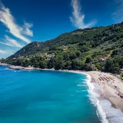
The eastern beaches are more beautiful and wilder, but the sea there is open and rougher. See Pelion's beaches.
Southern Pelion villages
- Vyzitsa: one of Pelion's most photographed villages, with two-storey stone mansions and a square with restaurants.
- Milies: a church with wall paintings and the station of the little mountain railway (the Moutzouris) with a museum. Especially good for families; see Pelion with kids.
- Pinakates: a quiet village that until 1979 could only be reached by mule.
- Argalasti: the main village of the south, with wineries and a Saturday farmers' market, near the beaches of Xinovrysi and Paltsi.
- Lafkos: one of the few car-free villages, with a radio museum and a long-running family café.
- Milina: a fishing village on the gulf, with fresh fish and kayaking to the small island of Alatas.
How to plan a route from the map
Pelion's roads are mountainous, narrow and winding, so a short distance on the map can take a long time. Think of your trip as loops:
- Day 1: centre. Volos, Portaria and Makrinitsa, continuing to Chania and the summit if you like.
- Day 2: east. Tsagarada and Mylopotamos beach, with Zagora on the way back.
- Day 3: south. Vyzitsa and Milies in the morning, then a gulf beach around Milina in the afternoon.
A car is almost essential. For areas to stay, see where to stay in Pelion; for the town at the foot of the mountain, see the Volos guide. The general guide is Pelion: villages, beaches, steam train and skiing.
FAQ
Which Pelion village is closest to Volos? Portaria, about 11 km from Volos, and neighbouring Makrinitsa.
Where are the best beaches in Pelion? On the east side, near Tsagarada and Zagora, with beaches such as Mylopotamos and Horefto. In the south, on the gulf, the sea is usually calmer.
How many days do you need in Pelion? 3–4 days let you see all three areas without rushing, as the roads are slow.
Do you need a car in Pelion? Almost always. Public transport between villages is limited.